
Contour Survey
- Home
- Contour Survey
A contour survey is a way to easily visually understand the vertical and horizontal shape (the “topography”) of your land. By understanding the land contours, you can easily visualise or map how water will flow over the property when it rains, where it will collect, where it might erode the soil and many other important water flow characteristics, where to build access roads and how to farm your property along the contours. From this simple base, you can even develop water flow models, stream maps and determine the best places to create dams and silt traps.
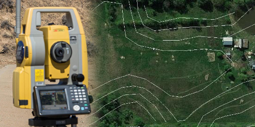
A contour line is an imaginary line which connects points of equal elevation. Such lines are drawn on the plan of an area after establishing reduced levels of several points in the area. A numerical value placed upon a contour line to denote its elevation relative to a given datum, usually mean sea level is called Contour Value. The contour lines in an area are drawn keeping difference in elevation of between two consecutive lines constant. Alternatively, a contour or a contour line may be defined as the line of intersection of a level surface with the surface of ground. This means every point on a contour line has the same altitude as that of the assumed intersecting surface. The process of tracing contour lines on the surface of the earth is called contouring and the maps upon which these lines are drawn are called contour maps. A contour map therefore, gives an ides of the altitudes of the surface feature as well as their relative positions in plan. Thus a contour map serves the purpose of both, a plan and a section.
Why are contour surveys are so important?
Elevation data is essential for planning your home or any building construction projects, and following the contours of the land is the cheapest way to build roads and tracks through your property. For many types of agriculture, especially tree crops (like mangoes, macadamias, avocados, etc), planting along the contours of the land is the best strategy for maximum yield.
In construction projects, contour mapping is an essential tool to first understand the structure of the site, then calculate how much soil and other material needs to be added or removed to make the structure of the site fit the construction plan, and then to understand and verify how the terraforming of the land fits with the engineering design.
Uses of Contour Maps
- The suitable site can be selected for construction activities.
- . Reservoir capacity can be determined.
- Alignment for roads, canals, transmission lines are done efficiently with the help of contour map.
- Nature of ground surface may be determined.
- Estimating the quantities of earthwork.
- The nature of ground i.e. flat, uniformly, sloping, undulating or hilly etc.
- It is possible to select the most suitable and economical sites for work such as the location of roads, railways, canals, pipelines, dams, reservoirs etc. by using contour map.
- Estimating of the volume of reservoir storage water, volume of earthwork in cutting and embankment can be done by using contour map.
Mithra Surveyors and Construction